Arlington's First Property Owners - 1876 (Part 1 of 5)
B. B. Paddock, publisher of the newspaper The Democrat in Fort Worth, said "A town lot sale was held on July 26, 1876, when 22 lots were sold, aggregating $1,738.50. J. A.H. Hancock was the auctioneer and Engineer C. H. Erwin represented the railroad."
The Texas and Pacific Railway Company had successfully completed the construction of the line from Dallas to Fort Worth one week earlier, on July 19, 1876, and wanted to take advantage of the public enthusiasm generated during the final six weeks of construction through their midst to sell properties in the town. Surveyors had been on the scene since 1872, planning a transcontinental railroad at first, but lately settling details of the right of way to Fort Worth and planning the railroad's development of a town to be called Johnson on 160 acres strategically located about halfway between the cities.
The town site crossed over a section line on the Texas General Land Office survey map for Tarrant County, the major portion of it in the Solomon Davis patent to the north and the remainder in the John Huitt patent to the south. As often happened, there was a public road along that section line, developed for convenient passage east or west. In those days, a man walking or on horseback could travel freely over the unfenced prairie, but wagons found it better to travel a road, especially through forested areas such as the Cross Timbers at this location. A road along a section line avoids trespassing on the scattered homesteads, which generally only had rail fences around the garden, the cow pen, and finally the house, in order of priority.
This road, called the Dallas and Fort Worth Road, would eventually be named Abram Street through the town of Arlington. We know that this was the route because in November 1877 the county road from Fort Worth to Arlington was changed so that it followed the curve of the north edge of the railroad right of way between Handley and Rush Creek. After crossing the Rush Creek bridge, the survey led "to the N. line of the M. Brinson Survey" which it followed for 2½ miles east to the northeast corner of the O. Medlin Survey, "thence East on Sec. Line about ½ mile to the town of Arlington." This is the road alignment that crossed to the south side of the railroad at Death Crossing. The road continued along the section lines to the east, for on February 2, 1905, "J. T. Johnson from the east side of town reports that the six miles of black mud road east of us is in a horrible condition and ought to be graveled."
Edna Christman wrote a short history of Arlington saying that "the old Dallas and Fort Worth road was here before the town was started," adding that "the town was covered with underbrush. This was removed by the state's convicts in 1876 when the railroad hired them from the state." Early land buyers would find the town site marked out with stakes where the streets were to be. James Ditto is credited with being overseer when the streets were laid out, possibly meaning that he told the convicts which trees to cut down. John W. Litton was given credit for removing the stumps from streets.
Mrs. F. V. Lawrence and her husband came to Arlington in November, 1876. She said that at that time only one store was operating in the town, owned and run by Jim Ditto, and the railroad depot was a tent.
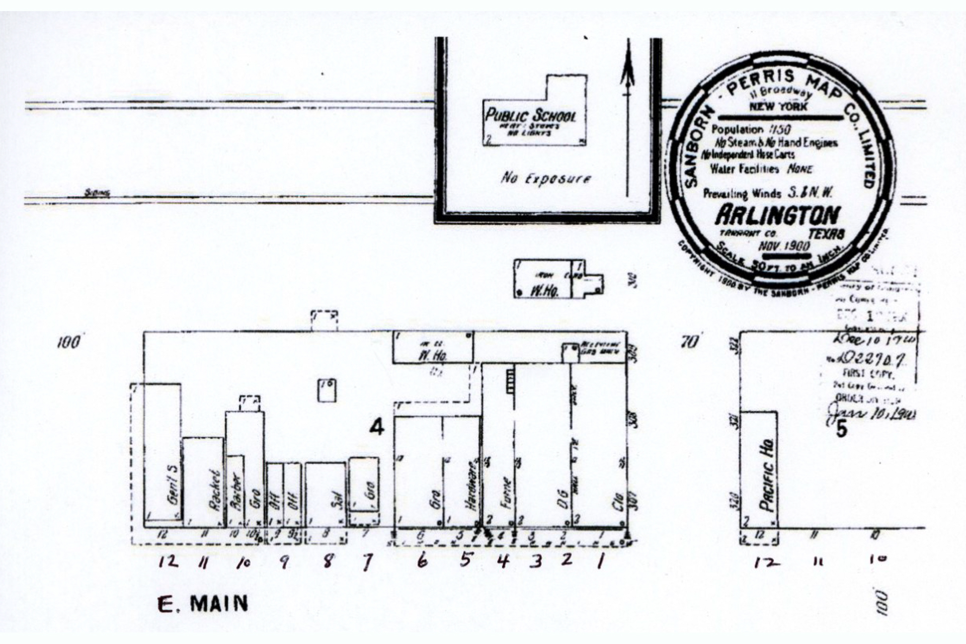
Arlington Postmaster J. I. Carter in 1927 said that the first post office "was named Hayter. At that time the site of this city was yet in the woods and not laid off. Uncle Jimmie Ditto kept the post office in his store about one-half mile east of the present town on the old Dallas and Fort Worth road. The town when first laid off was named Johnson by the railroad company and when the Postmaster asked the Department to change the name to Johnson he was informed that 'Johnson Station' post office was three miles south and that he would have to select some other name. At the suggestion of Web Ditto the name of Arlington was sent in and accepted by the Post Office Department. Immediately the railroad company accepted the name and changed the name of the town from Johnson to Arlington."
On the day of the land sale the plat for the new town would have been displayed as a poster at the tent/depot for potential buyers to view and consider advantages of available locations. Presumably it was titled "Johnson." It certainly did not show the existing public road through the property, since even its revision named "Arlington" and dated 1878 that has come down to us as the plat is devoid of any indication of it.
But the public near the town got to town by that road and others that came into use, such as Center Street to the north and south. They did not abandon it, nor buy lots that lay on it. The T & P Land Department may have reserved those lots from sale but did not make acknowledgment of the legal situation until 1900.
The table below shows the earliest sales of lots, through year-end 1876. The sale date is the date the buyer signed the deed. These deeds have been put in order of their location rather than the sale dates in order to consider them with regard to use, either business or residence, and how they fit into neighborhoods. The business center is the Main Street and Center Street intersection. Businesses north of the tracks and some residences in the northeast part of town selected by astute local families like Thomas and Tolliver come last. They were in it for the long haul, but some of the business lots were bought by speculators.
| Texas & Pacific Railway Company Arlington Land Sales in 1876 | ||||
|---|---|---|---|---|
| Buyera | Sale Date | Lot/Block | Location/Useb | Pricec |
| R S Johnsond | Jul 24 | 1-2/48 | S Center | $150 |
| W W McNatte | Jul 28 | 3/48, 1/19, 1/50 | S Center, E Main, S Mesquite | 220L |
| W H White | Jul 28 | 4/48 | S Center | 60L |
| N H Gammage | Jul 28 | 1/49 | S Center | 75L |
| J P Smith | Jul 28 | 2-3/49, 2/50f | S Center, S Mesquite | $157.50 |
| J D Cooper | Jul 28 | 4/49 | S Center | 62L |
| C C Wilson | Aug 1 | 1/18 | Main & Center | 150Lg |
| E M Murphy | Jul 28 | 2/18 | W Main | xh |
| J C Middleton | Jul 28 | 3/18 | W Main | 80.94 |
| William Harrison | Jul 28 | 4/18 | N Mesquite | 79.63 |
| R M Chapman & Alfred Miller | Jul 28 | 5/18 | W Main | 79.98 |
| G A Sergeant | Jul 28 | 6/18 | W Main | 90L |
| Mrs Fidie B Wagneri | Nov 25 | 1/3 | W Main | 135 |
| L T Fort | Dec 12 | 6/19 | E Main | 93.75 |
| W A Bledsoe | Dec 2 | 1/4, 6,20 | E Main, E Main | 232.50 |
| Middleton & Co. | Nov 2 | 1/40 | W Front | 150L |
| G W Hill | Oct 31, Dec 11 | 2/2, 1/34 | N Pecan | 195L |
| Wynne, Dennis & Beckj | Jul 28 | 1/2, 11-12/1 | W Front, E Front | 320L |
| W S Thomask | Aug 25 | 5-6/64 | E North | 1 |
| Joseph Tolliverl | Aug 8 | 6/63 | E North | 1 |
Notes to Arlington Land Sales in 1876:
aExcept as otherwise noted, the buyers resided in Tarrant County.
bThere were no street addresses until many years had passed and the U S Postal service required them. Locations are given here using N or S from Main Street, E and W from Center Street. Higher block numbers are farther from the center of town at the Main Street-Center Street intersection.
cTotal cost paid in cash unless marked L for an attached lien. Typical payment terms for properties with liens were one-half in cash and the rest by two payments on the first and second anniversaries of the purchase, with 10% interest added.
dR S Johnson was a 'sooner,' buying his prime location on the west side of Center Street four days before the scheduled sale.
eOf Union County, Arkansas.
fThis is the first deed to state its location as "in the plat of the town of Arlington" instead of Johnson. Since it was not filed until 29 Apr 1878, the new name had come to the attention of the county clerk when it was written in the deed book.
gThis deed filed 10 Oct 1876 was the last to state its location "in the town of Johnson." The name change must have been worked out late in 1876, since the U S Postal Service appointed James Ditto Postmaster of Arlington on 22 Jan 1877.
hThe original deed for the sale to E M Murphy was never filed and the purchase price is not known. On 22 May 1907 a supplementary deed was granted for a $1 fee. The supplementary deed was necessary to clear the title for resale. Its existence shows that the railroad's records were complete, with the land department located in Dallas by that time.
iOf Harrison County, Texas.
jOf Forrest City, Arkansas
kWhen W. S. Thomas sold 43.75 acres to the T & P for the town site he received $193.75 and also 60 acres in the W P Milby survey and the two town lots 5-6/64 as additional consideration for the deal.
lThe transfer of lot 6/63 from the T & P to Joe Tolliver was further consideration when he sold 14.69 acres to the railroad for the town site for $206.25 on 27 Oct 1876. The late date, after the railroad was fully operational, as well as the money figured out to the last 25 cents, is an indication of the hard bargaining done by Tolliver and other smart landowners like W. S. Thomas.