The Original Town of Arlington (Part 2 of 2)
Editor’s note: In the previous article, Tom Cogdell traced the creation of the T & P Railway Company plat of 160 acres (1/4 of a Section), its location, and the original grantors of land to the railroad for this 160 acres, granted in 1876.
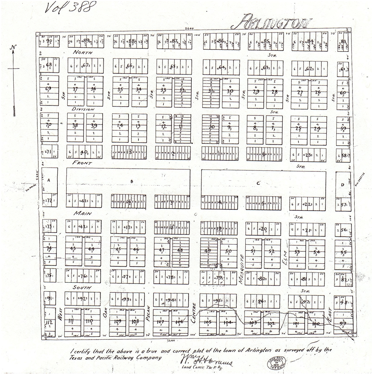
Below is a plat of the Town of Arlington which subsequently was laid out. The date of this plat is 1878:
There are several characteristics of the plan that are noteworthy:
1. The railroad is central, with the right of way and generous depot reservation ABCD running across the town at an angle about 92° from true north.
2. The streets are parallel to the railroad line (North, Division, Front, Main, and South) or perpendicular (West, Oak, Pecan, Centre, Mesquite, Elm, and East). All are interior to the town rather than on the edges, outside which as far as the plat is concerned might remain forest or prairie.
3. Main Street is widest. Division Street is narrowest, virtually an alley with no lots facing it.
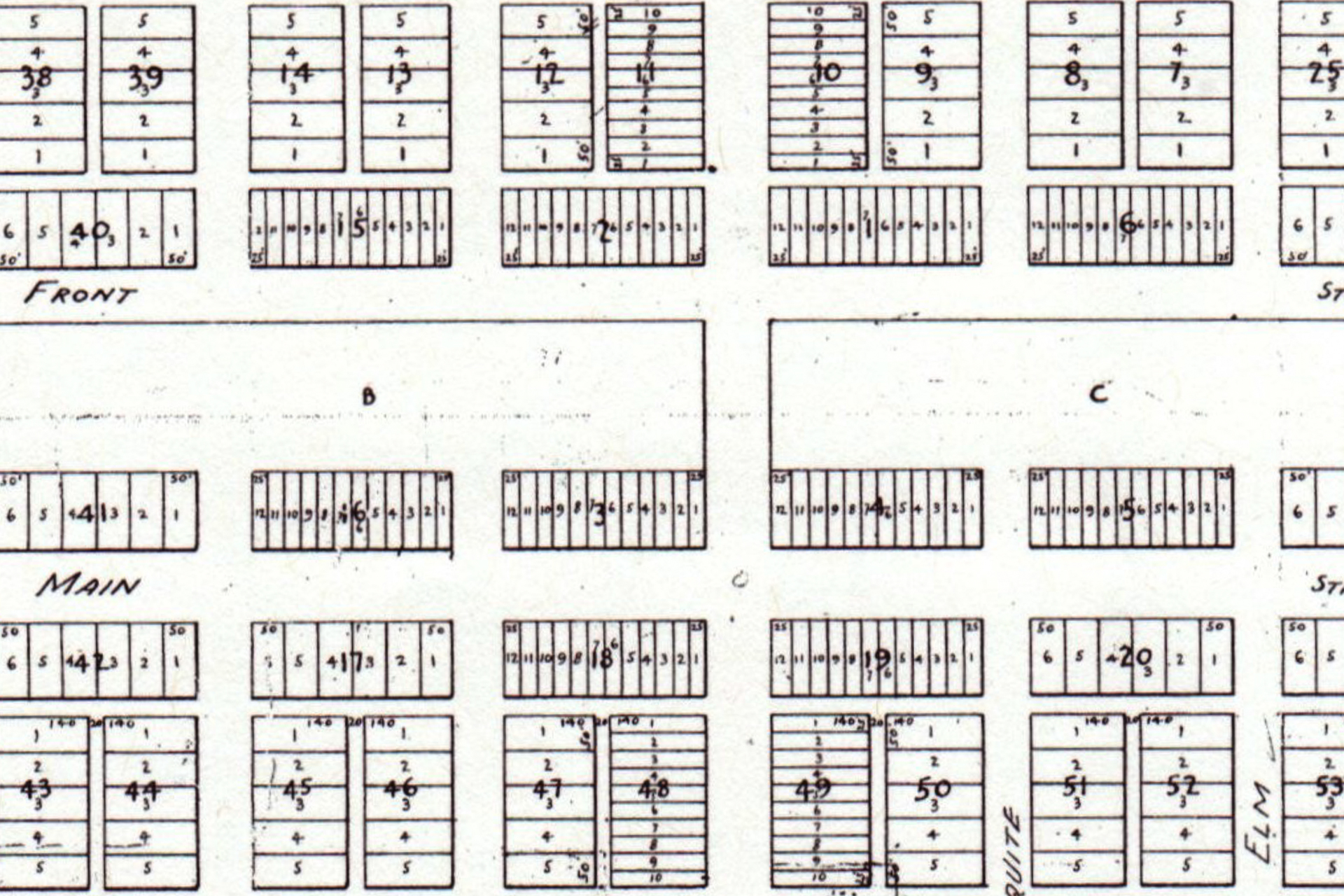
4. Lots in the central area are narrow for a compact business district, wall to wall stores.
5. Lots at the edges of town, forty in all, are trapezoidal, which could be difficult to fit with future development.
6. It ignores the presence of a road of the traditional kind made by pioneers along the section line between the Solomon Davis and John Huitt patents. It would later be named Abram Street. This remained in use and became an additional street that cut across the lots between Main Street and South Street at an angle, eliminating lots from sale, making additional lots irregular, and forming additional corner lots.
As a result of the continued use of the section line road, Arlington geography became more complex than the almost symmetrical plat and creative citizens found ways to use the "remainders" to fit their needs. For years city government was busy abandoning some lots and dedicating other spaces to meet needs that developed.
Finally, the T & P made acknowledgement that there was de facto a road across the town that was not on the plat. It made a dedication of streets from the Texas and Pacific Ry Co to the Public stating that "Whereas it was found necessary that the lots in the city of Arlington herein described should be used as streets of said town for the use and convenience of the public and whereas said Railway Company did on the 2nd day of March, 1900 make an offer to the City of Arlington through its Mayor C. D. King to donate said lots to public use as streets of said city conditioned that said city council adopt as the Official map of the City of Arlington the map of said town recorded on page 584 in Book H of the deed records of Tarrant County."
The T & P therefore dedicated Lot 3 Block 55 and Lot 5 Block 74 of the official map to the City of Arlington. These are the two lots on the east and west edges through which the section line ran, symbolic of dedicating the entire road.
Note the Tarrant Appraisal District Map of April 2, 2012, below, showing a portion of modern central Arlington, with the boundaries of the original town of Arlington shown with an added box.
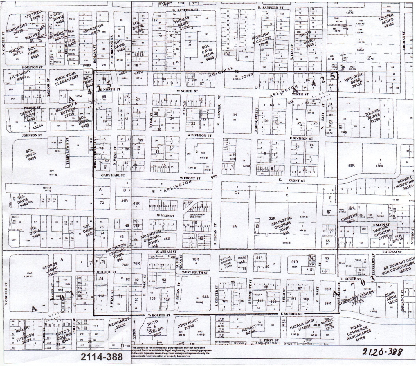
In the map above, the original Town of Arlington within the added box is surrounded by part of the modern city. Most streets in the old part align with or are at right angles to the railroad line (ABBCCD), whereas most which continue outside the old boundary turn 2° to the left to continue in the cardinal directions north-south and east-west. The exception is Abram Street, which follows the surveyed section line between the Solomon Davis and John Huitt patents marked with the broad gray line across the TAD map segments. The section line on the west edge of the two patents lies in Cooper Street at the left.
All block and lot numbers in old town retain their original plat numbers except where lots have been combined for larger projects. Block 4 at the northeast corner of Center and Main Streets has become enlarged by combination with Blocks 19-49-50 to form Block 4A for the George W. Hawkes Central Library. Remarkably, Arlington Municipal Building remains on Blocks 3-18-47 -48 though modified by the deviation of West Main Street to the north to make parking space and the clipping off of the south ends of Blocks 47-48 by their abandonment in 1900 to remain a public road.
Existing streets which were created on the boundary of the original town are Mary Street on the southeast, Border Street on the south (part of it now UTA Boulevard), and Indiana Street on the west (part of it abandoned and part now Jerry Crocker Street). Alleys lie along some of the boundary, especially on the north and southwest. Outside the square of the original town, you can still find plots bearing the names of Sol Davis and John Huitt from the patents, but also names of owners who participated in later developments, the Thomas Heirs, Toliver Acres, and more.